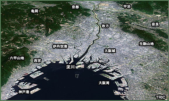
Images around Yodo river seen from Labdsat-8
This is 3D image around Yodo river (Osaka bay) constructed from satelite image of Landsat-8.
Data acquisition:2014/3/17
Satellite data:Landsat-8 OLI(Operational Land Imager)
Receiving station:TSIC (Tokai University Space Information Center)
Elevation data: Geographical Survey Institute base map information 10m digital elevation model
Credit:
The source data was downloaded from AIST's Landsat-8 Data
Immediate Release Site, Japan.(http://landsat8.geogrid.org),
Landsat 8 data courtesy of the U.S. Geological Survey.
Imge Processing :Tokai university Research & Imformation center