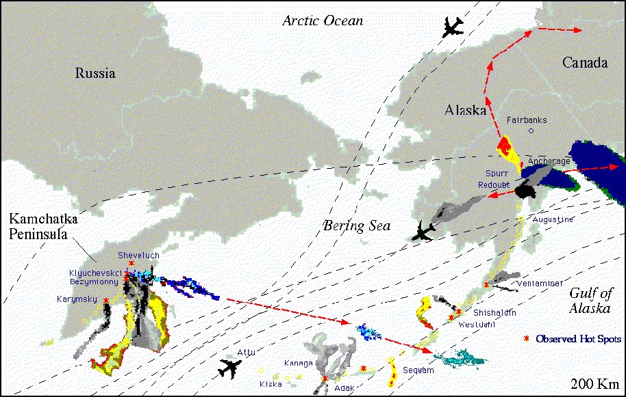
This image shows the cumulative volcanic eruptions in the North Pacific Ocean Region since 1990. The eruption clouds shown are derived from AVHRR satellite imagery.
Why this area so important?
This image shows the cumulative volcanic eruptions in
the North Pacific Ocean Region since 1990. The eruption clouds shown are
derived from AVHRR satellite imagery.
Many of the small plumes and those around Anchorage and the Kamchatka Peninsula are not shown due to the large number of clouds that would form a single gray mass or would make the image too busy in those regions.
This page is provided from Alaska Volcanic Observatory for GOIN demonstration.
![]()
![]()
Copyright(C)1996, by Tokai University Research &
Information Center
No reproduction or republication of any contents on TRIC HOME PAGE without
written permission
All Rights Reserved
e-mail:kcho@keyaki.cc.u-tokai.ac.jp
Updated on October 17, 1996