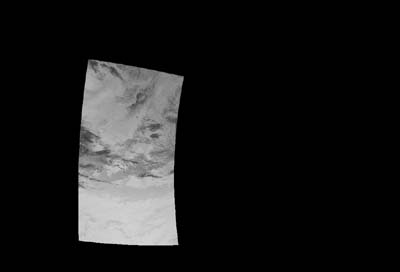
One pass image of NOAA received at Tokai Univ. Multiple pass image of NOAA received at Tokai Univ.
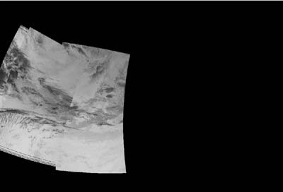
1. Each side receives the NOAA/AVHRR data, and make
a
local mosiac image of the multiple
passes.
One pass image of NOAA received at Tokai Univ.
Multiple pass image of NOAA received at Tokai Univ.
2. In the end of the day, each side transfers the
mosaic
image to the partner via Internet.
3. After receiving the mosaic image of the partner,
each
side will combine their local mosaic
image with the
partner's image and make a joint mosaic
for wide area
disaster monitoring.
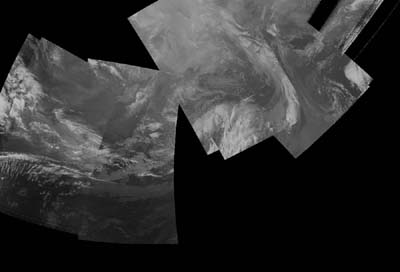
Joint mosaic inage of Tokai Univ. and Univ. of Alaska Fairbanks
![]()
![]()
Copyright(C)1996, by Tokai University Research
& Information Center
No reproduction or republication of any contents
on TRIC HOME PAGE without written permission
All Rights Reserved
e-mail:kcho@keyaki.cc.u-tokai.ac.jp
Updated on March 23, 1998