■Achevements of TRIC (Chronological table)
2015
Development of wide area land cover classification algorithm
Development of a geoscientific data analysis system for harmonized utilization of the terrestrial renewable energy
Research of handwriting computer analysis
Application research of digital camera photograph
Research of crime prevention video image analysis and high-definition video shooting technology for justice
Research of satellite data utilization in developing educational product
Image product cooperation to NHK on-demand (8)
4K video contents development (8)
Research of universal applicable archaeological remote sensing method using space-borne SAR
Study on technology for the ruins exploration and its practical use by complex utilizaion of the multi-satellite data
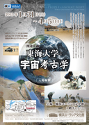
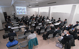
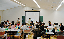
TRIC research and development workshop 2014
Exhibition of Tokai university & Space Archaeology(~05.April.2015)
Joint research of history and environment in east asia(Gakushuin Univ.)
Joint research on cities in cmmandery and counties in Han Dynasty played in the formation of the East Asian cultural area (Toua Univ.)
Joint research on restration, deciphering and publishing of Tokai Univ. ancient Egyptian papyrus document collection(Faculty of Letters)
Study on the mutual use of sea ice observation data
Study on the Antarctic research ship Shirase navigation assistance by using satellite data
The agreement of coopration between TRIC and CSRSR of the National Central Univ.,Taiwan
agreement with CSRSR of the National Centeral Univ.,Taiwan
2014
Development of wide area land cover classification algorithm
Development of a geoscientific data analysis system for harmonized utilization of the terrestrial renewable energy
Research of handwriting computer analysis
Application research of digital camera photograph
Research of Landsat-8 receiving system
Research of satellite receiving system
Development of high- precision GCP collection system using digital map database
Research of crime prevention video image analysis and high-definition video shooting technology for justice
Forest change monitoring of Kumamoto Prefecture (28)
Research of satellite data utilization in developing educational product
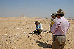
Archaeological research in the west delta of the Nile, Egypt (5)
Image product cooperation to NHK on-demand (7)
4K video contents development (8)
Research of universal applicable archaeological remote sensing method using space-borne SAR
TRIC research and development workshop 2013
Ancient environment research of Qin Shi Huang mausoleum and Han's imperial mausoleums (6)
Exhibition of Tokai university & Space Archaeology
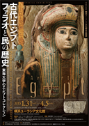
Tokai Univ. & Yokohama museum of Eurasian Cultures c ollaborate exhibition
"Pharaohs and People of Ancient Egypt"4K images
2013
The 40th anniversary of TRIC
Development of wide area land cover classification algorithm
Development of a geoscientific data analysis system for harmonized utilization of the terrestrial renewable energy
Research of handwriting computer analysis
Application research of digital camera photograph
Research of Landsat-8 receiving system
Research of small satellite receiving system
Development of high- precision GCP collection system using digital map database
Research of crime prevention video image analysis and high-definition video shooting technology for justice
Forest change monitoring of Kumamoto Prefecture (27)
Research of satellite data utilization in developing educational product
Archaeological research in the west delta of the Nile, Egypt (4)
Image product cooperation to NHK on-demand (6)
4K video contents development (7)
Research of universal applicable archaeological remote sensing method using space-borne SAR
TRIC research and development workshop 2013
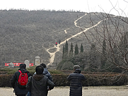
Ancient environment research of Qin Shi Huang mausoleum and Han's imperial mausoleums (5)
Development of a geoscientific data analysis system for harmonized utilization of the terrestrial renewable energy
Research of wide area environment monitoring by using satellite image
Development of educational digital contents
Research of handwriting computer analysis
Application research of digital camera photograph
Research and development of high performance small satellite receiving system
Research of crime prevention video image analysis
Archaeological application of satellite remote sensing
Development of wide area land cover classification algorithm
Ancient environment research of Qin Shi Huang mausoleum (4)
Satellite image processing & cooperation "Great Summits, great mountains of the world " (5)
Forest change monitoring of Kumamoto Prefecture (26)
Development of Kaguya moon glove
Archaeological research in the west delta of the Nile, Egypt (3)
A study of archaeological site exploration using space-borne SAR (8)
4K video contents development (6)
Image product cooperation to NHK on-demand (5)
TRIC research and development workshop 2012
2011
Satellite image processing & cooperation "Great Summits, great mountains of the world " (4)
Ancient environment research of Qin Shi Huang mausoleum (3)
Archaeological research in the west delta of the Nile, Egypt (2)
A study of archaeological site exploration using space-borne SAR (7)
Forest change monitoring of Kumamoto Prefecture (25)
Development of world map database (5)
Image product cooperation to NHK on-demand (4)
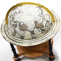
Development of a new night time globe (2)
4K video contents development (5)
TRIC research and development workshop 2010/2011
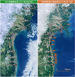
Special seminar "image from earth observation satellites/The Great East Japan Earthquake
-Preparation against next disaster-"
(Image data:NASA GDAAC MODIS SUPPORT TEAM)
2010
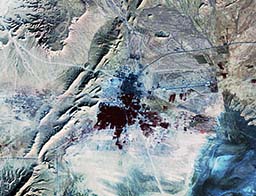
Ancient environment research of Qin Shi Huang mausoleum (2)
Archaeological research in the west delta of the Nile, Egypt (1)
A study of archaeological site exploration using space-borne SAR (6)
Satellite image processing & cooperation "Great Summits, great mountains of the world " (2)
Forest change monitoring of Kumamoto Prefecture (24)
Development of world map database (4)
Image product cooperation to NHK on-demand (3)
Development of a new night time globe (1)
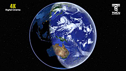
4K video contents development (4)
2009
4K video contents development (3)
Satellite image processing & cooperation "Great Summits, great mountains of the world " (1)
A study of archaeological site exploration using space-borne SAR (5)
Forest change monitoring of Kumamoto Prefecture (23)
Cooperation to a JAXA's PR exhibition in Tokyo station (1)
Satellite image processing for total solar eclipse
Cooperative research with Research Institute for Oriental Cultures Gakushuin University (2)
Ancient environment research of Qin Shi Huang mausoleum (1)
The agreement of cooperative research between TRIC and Archaeological Institute of Kashihara,Nara signed
Development of Mars globe (2)
Development of satellite map using ALOS image
Development of world map database (3)
Image product cooperation to NHK on-demand (2)
TRIC research and development workshop 2009
Delivery lecture ; Story of the earth"
on August 30,2009
2008
The 35th anniversary of TRIC
Satellite image processing & cooperation "World heritage: The Great Stories, Tanken roman Sakai isan(NHK general TV)" (4)
Development of 4K Ultra-High definition imaging system (2)
Forest change monitoring of Kumamoto Prefecture (22)
A study of archaeological site exploration using space-borne SAR (4)
Development of Moon globe "Kaguya" and Mars globe (1)
Development of world map database (2)
The director of National Authority for Remote Sensing & Space sciences of Egypt visited TRIC
The agreement of cooperative research between TRIC and Research Institute for Oriental Cultures Gakushuin University signed (1)
Satellite image processing & cooperation "Japanese great mountains, Nihon no meihou (NHK general TV)"
Image product cooperation to NHK on-demand (1)
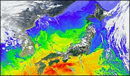
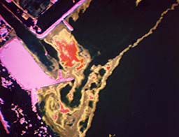
Surface temperature image over the Japan sea
autumn, October 4
2007
Satellite image processing & cooperation "World heritage: The Great Stories, Tanken roman Sakai isan(NHK general TV)" (3)
Forest change monitoring of Kumamoto Prefecture (21)
A study of archaeological site exploration using space-borne SAR (3)
Image processing for Gio-cosmos Miraikan (2)
4K Ultra-High definition Imaging System installed
Satellite image processing & cooperation for Kyushu national museum
Production of broadband contents
Satellite image processing & cooperation for Kobe science museum
Development of a new big globe
Development of world map database (1)
A study of archaeological site exploration
using space-borne SAR
2006
The 20th anniversary of TSIC
Satellite image processing & cooperation "Japanese great mountains, Nihon no meihou (NHK BS&Hi-vision)"
Satellite image processing & cooperation "World heritage: The Great Stories,Tanken roman Sakai isan(NHK general TV)" (2)
Forest change monitoring of Kumamoto Prefecture (20)
A study of archaeological site exploration using space-borne SAR(2)
Development and production of satellite image contents
The agreement of cooperation between TRIC and Miraikan,National Museum of Emerging Science and Innovation signed
3D image of Mt.Fuji from kanto area
2005
Satellite image processing & cooperation "High way stories, Kaido Monogatari(TV Asahi)"
Satellite image processing & cooperation "World heritage:The Great Stories, Tanken roman Sakai isan(NHK general TV)"
Forest change monitoring of Kumamoto Prefecture (19).
Satellite image processing & cooperation "Japanese great mountains, Nihon no meihou (NHK BS&Hi-vision)"
A new LANDSAT map of Kanto-Koshinetsu published
A study of archaeological site exploration using space-borne SAR (1)
Development and production of satellite image contents
Satellite image analysis for the massive tsunami in the Indian ocean
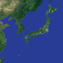
Satellite image over whole area ofJapan
2004
The 30th anniversary of TRIC
Satellite image processing & cooperation "Data map - A map of billions of people (NHK), (Los Angeles zoom image/data:MODIS,NASA)
Production of a large-scaled satellite globe for Aichi Expo.
Aurora image providings for a cellular phone network.
Forest change monitoring of Kumamoto Prefecture (18).
An environmental investigation of the Sichuan Silkload of China using satellite images.
Satellite image processing & cooperation "One only the earth (NHK education)".
A new development of MODIS globe.
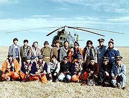
Satellite information assistance to the western Kunlun mountaineering party of Tokai Univ.
Satellite image processing & cooperation "Why did the phantom ancient Roman city of Pompeii disappear in 19 hours?".
Satellite image processing & cooperation "New Silkload (NHK)".
Satellite image coorperation"Earth waching (Broadband).
Satellite image processing & cooperation "A beautiful and blue earth mater"
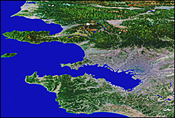
Satellite image processing & cooperation for Sapporo city.
Establishment of a new satellite image database of Japan islands.
Zooming image of Los Angels:North America
2003
Satellite image processing and cooperation for Green Map III (edition of the Jananese archipelago)
Satellite image processing & cooperation for a NHK TV program "Datamap-A map for 6.3 billions of people"
Development of low luminance astronomical observation systems (2)
Forest change monitoring of Kumamoto Prefecture (17)
Paleoenvironment study for desertification areas in China using satellite data
Development of low cost image processing
Satellite image processing to produce the moon and Mars globes
Cooperation to produce a Hi-vision video program for 100th anniversary of Teshikaga-cho
Cooperation to publish an educational exhibition software"Furusato touch"
Satellite image examples for Green Map III:
Mt.Aso, Hokkaido,Shinjuku, Kanto, Mt.Fuji, Osaka
2002
Egyptian-Japanese joint seminar on space sciences and technology was held in Cairo,Egypt
Development of satellite image program for a broadband broadcasting
Paleoenvironment study for the Mekong river basin using satellite data
Forest change monitoring of Kumamoto Prefecture (16)
Development of low luminance astronomical observation systems (1)
Trial production of low cost HRPT receiving system
Development od a new night time globe
Satellite image processing & cooperation for a NHK TV program"Wonders of the great earth nature-Chikyu Fushigi Daishizen"
Satellite image processing & cooperation for a NHK TV program"Appearance of the Hotan"
NHK Hi-vision"Satellite view" (4)
Development of low cost image processing system
Satellite image processing & cooperation for the Yokohama musium for Eurasian cultures
Satellite image processing & cooperation for the Misawa aviation & science musium
An experiment of aurora photographing in Araska using low luminance astronomical observation system
2001
Production of Soccer ball & Volleyball type globe
Paleoenvironment study for the Chang Jiang river basin using satellite data
NHK Hi-vision"Satellite view" (3)
Forest change monitoring of Kumamoto Prefecture (15)
Cooperation to display satellite image for the Earth science and future pavilion
Leonids meteors observation
Satellite image processing & cooperation for a NHK TV program "Wonders of the great earth nature-Chikyu Fushigi Daishizen"
Earth symphony in Kumamoto
Cooperation to display satellite images for Hobetsu earth experience pavilion
Cooperation in satellite image display for the Kanagawa prefectural life planet earth museum
Paleoenvironment study of the Chang Jiang
2000
Thechnical support for earth observation experiments(STS-99) of Space Shuttle using HDTV
The first dawn of year 2000 acquired by satellite (The Yomiuri)
NHK special TV program"The four great civilizations" cooperated
Paleoenvironment study of the Huang He using satellite data
NHK Hi-vision "Satellite view" (2)
Forest change monitoring of Kumamoto Prefecture (14)
Valk ancient globes produced
Landsat map of Nagasaki published
Image interpretation of mural massages by A-bomb survivers at Fukuromachi elementary school, Hiroshima
Participation in Earth observation fair 2000
Reproduct of Valk ancient globes
1999
The 25th anniversary of TRIC
NHK Hi-vision program"Satellite view"(1)
HDTV camera system introduced
Nuclear pollution analysis of Mayac, Russia
Earth symphony in Kochi
Paleoenvironment study for the four great ancient civilizations using satellite data(1)
A study for Silkroadlogy in Qinghai province of China
Forest change monitoring of Kumamoto Prefecture(13)
Digital archive of the globes in the 18 century
Night time glove seen from satellite produced
Grand Canyon 3D image processed and broadcasted
Educational satellite image map software"GREEN MAP"developed
Participation in Earth observation fair 1999
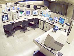
Image processing section in1999
1998
Semi-realtime Hi-vision satellite image broadcasting started
NHK Hi-vision TV program"Good morning earth-Ohayo Chikyu"image processed
Video image analysis of Kitora burial mound
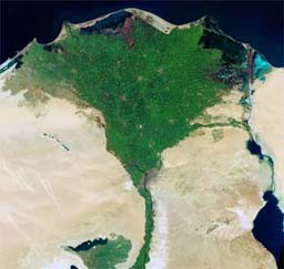
Paleoenvironment study of the Nile basin using satellite data(2)
Flood monitoring for the Chang Jiang river
Forest & grassland fire monitoring for the Maritime Provinces
Earth symphony in Tottori
Forest change monitoring of Kumamoto Prefecture(12)
HDTV image processing from Space shuttle(STS-95)
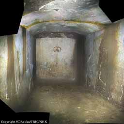
Mosaicked video image of inner stone chamber:
Kitora burial mound
1997
Semi-realtime satellite monitoring system operated
Paleoenvironment study in the western part of China
Paleoenvironment study of the Nile basin using satellite data (1)
Forest fire minitoring of Mongolia
Assumptive restoration of Kudara Kannon statue
Forest change monitoring of Kumamoto Prefecture (11)
Hi-vision 3D satellite animation of Tateyama produced
Night time earth image seen from satellite produced
Night time earth image seen from satellite produced
1996
A map of the Silk raod completed
Dr. Baker of NOAA administrator visited TRIC
The agreement of cooperation between TRIC and NASDA in the field of earth observation signed
The 10th anniversary of TSIC
Discovery of ancient Egyptian remains"Dahshur North" by the utilization of satellite data
A study of video image analysis for aircraft accident
AVNIR image processing
Ancient Izumo restoration
A study for video image analyses in crime prevention
Forest change monitoring of Kumamoto Prefecture (10)
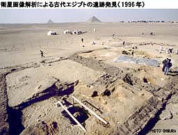
Discovery of ancient Egyptian remains"Dahshur North"
1995
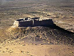
A new research program of unknown pyramids exploration started
Satellite images for NHK weather forcast produced
Disaster monitoring of Hanshin earthquake
Pyramids exploration from space (1)
Disaster monitoring of earthquake off Sakhalin
Pyramids exploration from space (2)
Forest change monitoring of Kumamoto Prefecture (9)
A study for the next forest resource system in Kumamoto prefecture
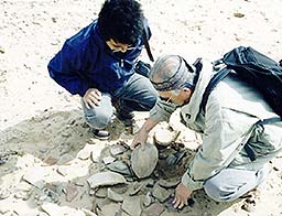
Ground truth for unknown ancient Egyptian site
1994
The 20th anniversary of TRIC
Paleoenvironment study of Khorezum (Uzbekistan)
Animated Hi-vision satellite cloud image produced
Forest change monitoring of Kumamoto Prefecture (8)
Hi-vision image recording system developed
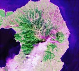
Paleoenvironment study of Khorezum:
A view of Ayaz-kala No.2
1993
Hi-vision satellite image produced
Land cover investigation of the metropolitan area
X-ray image analysis of ancient swords unearthed from Fujinoki burial mound
Satellite image analysis of Masuda city
Forest change monitoring of Kumamoto Prefecture (7)
Hi-vision image recording system developed
Land cover investigation of the metropolitan area
1992
Drifted buoy experiments in the Pacific started
International space year memorial satellite image software"Earth environments seen from space"developed
Mural painting analysis of Takamatsuzuka burial mound
Investigation of ancient temple "Kamiyodo-haiji"
Gurvan gol project (3)
Ocean current monitoring for the northern Pacific using drifted buoy
Forest change monitoring of Kumamoto Prefecture (6)
Landscape simulation of a golf course using satellite data
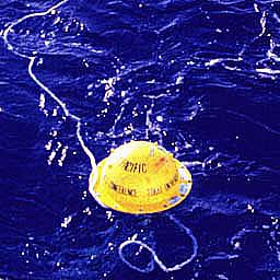
Drifted buoy experiments
1991
Planning & managements for the earth experiment pavilion in Hobetsu, Hokkaido
Satellite monotoring for Gulf war
Gurvan gol project (2)
Volcanic eruption monitoring of Mt. Pinatubo (Phillipine)
Volcanic eruption monitoring of Mt.Fugen, Unzen
Forest change monitoring of Kumamoto Prefecture (5)
Volcanic eruption monitoring of Mt.Fugen, Unzen
1990
Gurvan gol project (1)
Satellite monitoring for Nuclear sites of Eastern Asia
Investigation for ancient ruins of Palmyra, Syria
Satellite monitoring of Novayazemra islands (Russia)
Environment monitoring for northern territories of Japan
Satellite image processings for a NTV TV program "Ultra quiz" (2)
Forest change monitoring of Kumamoto Prefecture (4)
Investigation for ancient ruins of Palmyra, Syria
1989
Gurvan gol project started in Mongolia
Planning & managements for the earth experiment pavilion of the Yokohama Expo'89
Satellite image processings for a NTV TV program "Ultra quiz" (1)
Mural painting analysis of Horyuji temple
Forest change monitoring of Kumamoto Prefecture (3)
Pre-investigation of Gurvan gol project
1988
Observation of inner coffin of Fujinoki burial mound using endoscaope
Environment monitoring of Lake Inawashiro
Land cover change monitoring of Yokohama
Satellite monitoring of Kola peninsula
Forest change monitoring of Kumamoto Prefecture (2)
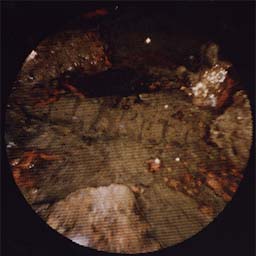
Observation of inner coffin of Fujinoki burial mound using endoscaope
(Image/Arcaeological Institute of Kashihara,Nara)
1987
Satellite image processing cooperations for a NHK TV program "Earth travelling, Chukyu Daikiko"
Forest change monitoring of Kumamoto Prefecture (1)
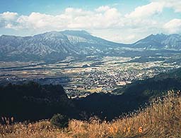
Forest change monitoring of Kumamoto
(View from investigation point of South-Aso)
1986
Space information center(TSIC) established in Kumamoto
Satellite monitoring of Chelnobyl accident
Image analysis of JAL's aircraft accident
Volcanic eruption monitoring of Izu-ohshima
Hi-vision based satellite earth rotating image produced
TSIC
1985
NHK TV "The world weather"broadcasted
Producing real time earth rotation image using meteorological satellites data succeeded
The first satellite globe in world history produced
Satellite animatted image zooming in on the top of Mt. Fuji produced
Land cover classification of Shimane Prefecture
A view of live broadcast "The world weather"
1984
The 10th anniversary of TRIC
NHK TV "The 21 century warned" broadcasted
"Landsat Map"published
Land use trend investigation of the Tsurumi river basin
Landsat mosaic of the Korean peninsula completed
Volcanic eruption monitoring of Mt.Etona, Italy
Development of unmanned hydraulic coal mining system
Cooperation of the movie production for"Gozila"
Satellite earth rotation image produced
The first earth rotation image in the world
1983
Land cover investigation of the Tsurumi river basin
Landslide detection using satellite data
Landscape simulation for urban area
"Computer Imaging"published
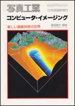
Computer Imaging
1982
Landsat mosaic of Japan completed
"The Japanese islands seen from space"published
Water quality monitoring of Lake Balaton, Hungary (2)
Land cover classification of Osaka area
Image analysis for a damaged mural painting of Senbonenmado, Kyoto
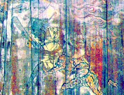
Emphasized color processing image of mural painting
in Senbonenmado,Kyoto
1981
The headquarter of TRIC moved to Yoyogi campus
Uranium ore exploration using satellite data(Mali)
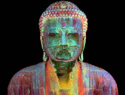
Investigation of Kamakura Buhdda statue
Sendai remote sensing project
Water quality monitoring of Lake Kasumigaura
Satellite monitoring for peace keeping started
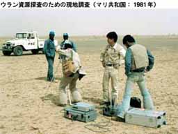
Uranium ore exploration using satellite data in Mali
1980
Water quality monitoring of Lake Balaton, Hungary (1)
Investigation of Kamakura Buddha statue
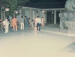
A view of night investigation for
Kamakura Buddha statue
1979
Taisha bay (Shimane) remote sensing (2)
Environment monitoring of Tokai University's campus (2)
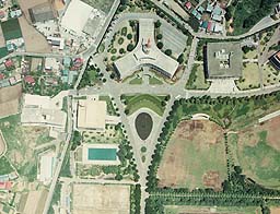
Aerial photograph over Tokai Univ. (Shonan campus)
1978
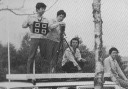
Remote sensing experiment using a radio-controlled plane
Land cover investigation of Sagami river basin (2)
Environment monitoring of Tokai University's campus (1)
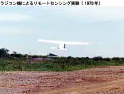
Remote sensing experiment
using a radio-controlled plane
1977
Digital image processing system installed
Developments of image processing system and its software started
Land cover investigation of Sagami river basin (1)
Taisha bay (Shimane) remote sensing (1)
Investigation of Kamakura Buhdda statue
Investigation of Sugar cane crop (Okinawa)
Exhibition"Kochi city seen from sky for the past 20 years"
Erosion observation of the Kamakura Buddha statue:
IR color image
1976
Area measument utilizing image processing technology
Environment monitoring of Route 271
Development of Multiband Camera
Ground Truth using developped Multiband Camera
1975
Image processing subcenter establiched (Isehara campus)
Oil pollution monitaring of Mizushima,Setonaikai
Analog image processing of Oil polutuion in Setnaikai
1974
TRIC established (Shonan campus)
Analog image processing system installed
Bogor project (Indonesia)
Mt.Fuji ground truth
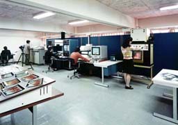
Image prosessinng section in 1974