SeaWiFS image received at Tokai University
GO TO: Home| What's New!| About TRIC| About TSIC| Project| Research| Information| Publication| Links
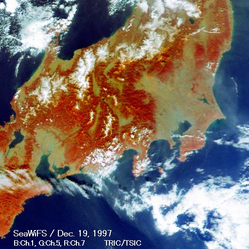
SeaWiFS image
received at Tokai University
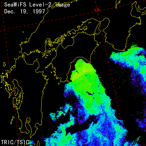
SeaWiFS Level-2 image processed
at Tokai University
A ocean-color sensor SeaWiFS(Sea-viewing Wide Field-of-view Sensor) on board the satellite OrbView 2 was successfully launched on Aug. 1, 1997 from Vandenberg Air Force Base, CA, USA. The SeaWiFS project is part of NASA's Mission to Planet Earth Enterprise to study the Earth as a global system. Under the agreement with NASA, the Tokai University started to receive SeaWiFS data at TSIC in Kumamoto, Japan from October 1997.
The SeaWiFS project is organized under the government-industry partnership. The Orbital Science Corporation(OSC) is reponsible for the SeaWiFS instrument integration, satellite construction, launch, command and control and tracking. NASA has contracted with OSC to provide, for five years, the raw satellite data which will be used for research purposes. OSC will own the data rights for operational and commercial purposes.
Copyright(C)1997, by Tokai University Research
& Information Center
No reproduction or republication of any contents
on TRIC HOME PAGE without written permission
All Rights Reserved
e-mail:kcho@keyaki.cc.u-tokai.ac.jp
Updated on December 22, 1997