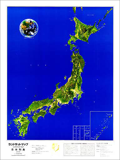
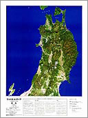
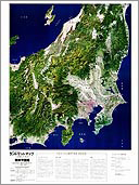
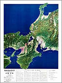
The earth observation satellite Landsat was launched by American National Aeronautics and Space Administration (NASA). Landsat observes the earth surface information from an altitude of approx.715 to 915km. Data acquisition over Japan is carried out around 9:30 a.m.(sun-synchronous orbit). Landsat travels around the earth in approx.103 minutes and comes back to the same position at the same time of the day every 18 days. The data over Japan is received by EOC at Hatoyama and handled.
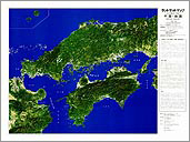
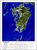
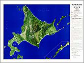
Landsat data covers an area of 185 km x 185 km in 1 scene. In order to look at the whole Japan with Landsat data, approx. 60 scenes are necessary. Landsat map of Japan was produced by computer mosaic with 72 Landsat MSS scenes.
On the map, an area looked in green color corresponds vegetation. The forest of Tohoku region and the mountains zone of the Chubu District is reflected in green, bluish green color, yellow green because of different kinds of trees or a difference of condition (seasonal variation of a deciduous tree). Agriculture field and grass land are reflected more light in the bright green color than the forest. However there is a big seasonal change in an agriculture field ( especially in a rice field) which influences the color of Landsat map. Rice field in the Niigata plain, when it was just in the season of rice-planting, is reflected in pink color. On the other hand, rice field in the Kanto plain after the harvest time is reflected in blight color similar to bare ground. Urban area (city and town) spreading out in a plain is shown in red and purplish red color. As for looking white color in the Ou mountain range and the central Alps mountain range is snow. However, white color covering mountains zone of the central Hokkaido, the west side of Mt. Teshio mountainous district and the north of Kobe are clouds.
 Kinki/Chubu